Call +1.212.765.7740
Expedition Stories
Our fleet navigates the world in search of adventure. These are the stories they bring back…
Loading...
Loading...
Previous Reports
7/30/2013
Watch
National Geographic Explorer
Ilulissat, Disko Bay, Western Greenland
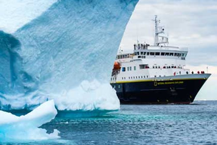
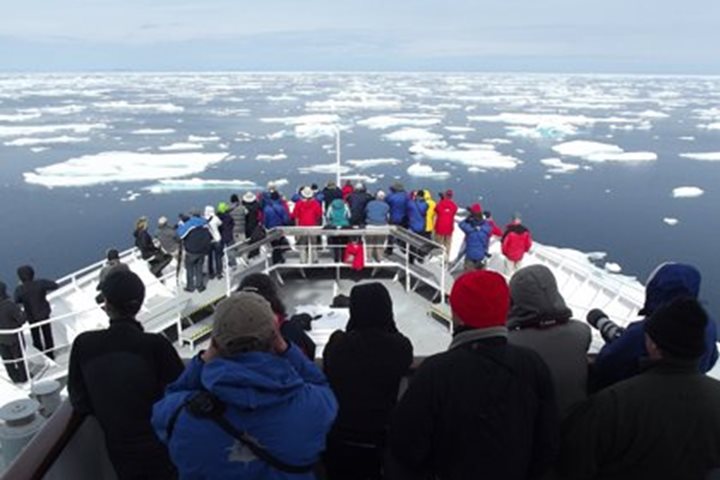
Every day of an expedition is exciting, but we all knew today in Greenland would be special. First thing this morning, National Geographic Explorer encounters the huge icebergs calved from Jakobshavn, one of the largest and most active glaciers in the world. If you’ve seen the movie Chasing Ice by National Geographic photographer James Balog, this was the glacier captured on film calving an iceberg the size of Manhattan. The ship navigates through the ice before anchoring offshore Ilulissat, the small settlement that translates to “The Icebergs.” It’s easy to see why this area is a UNESCO World Heritage Site. Towering icebergs block the entrance to the fjord, with the active face of the retreating Jakonshavn, now more than 40 miles from the entrance. The icebergs here are on a scale rivaled only by the ice in Antarctica. It’s a busy day coming and going from the ship, with options for walks in town, a hike out to an overlook of the ice-choked fjord, boat tours with local captains among the icebergs, a Greenlandic food tasting, and flightseeing operations to the Greenland icecap. Words can’t really describe how spectacular the icebergs are, or how interesting the light was in the afternoon. For that you need images. Taking advantage of the perfect conditions, a helicopter was made available to photograph the ship navigating through the ice. With the evening recap cancelled, and cameras and cocktails in hand, it was all hands on deck with proper dress for this spontaneous photo opportunity. It’s events like this that make traveling on National Geographic Explorer a true expedition, and also an unforgettable experience.
8/1/2013
Read
National Geographic Explorer
Baffin Bay
Yesterday we set off from above Disko Island on the west coast of Greenland, course west-northwest for Canada. There was an impressive sea running as we left the rugged cockscomb mountain of Uummannaq Island behind us and punched out into Baffin Bay. In times past, these were notorious waters, braved by the whalers and sealers who had come to plunder the rich bounty of the Arctic seas. Those who tarried too long got caught by the early onset of winter and found themselves caught fast in the grip of an ocean that had frozen overnight. Such tales of hardship, starvation and dogged human survival make for gripping reading today. We are lucky to be here in summer with all the safeguards of internet weather forecasts and ice charts to warn us of impending peril. By early morning we were into calmer, richer waters: kittiwakes and fulmars crisscrossed our path, sleek long-tailed jaegers swept past on athletic wings. There were thick-billed murres feeding on the water and small gangs of dovekies whirring low over the waves like bumblebees. Rich waters indeed. This mix of warm southern and frigid Labrador currents feeds everyone from copepod to leviathan. But besides the whalers, there were men with eyes on a greater prize: the Northwest Passage, gateway to Cathay and all the fabled riches of the East. One of the first to come here was Martin Frobisher, ex-pirate, darling of the virgin queen, Elizabeth the First, and self-styled adventurer. In 1567, he reached the southern tip of Baffin Island (at the eponymous Frobisher Bay) where he had a skirmish with Inuit (who captured five of his men) but returned with black rocks that promised gold. In two subsequent voyages his dream of a gold rush expired without profit. Fifty years later, the great Henry Hudson arrives on behalf of the British East India Company, charts a route through to Hudson Bay and lays the foundation for a company which will endure for another three centuries. In 1616 comes another quest for the NW Passage, led by William Baffin. He followed our own route round the southern tip of Greenland, up to the bay he named after Lord Melville, first Lord of the Admiralty, and then down the east side of the island to which we are headed; his name is immortal now, for we are crossing Baffin Bay en route to Baffin Island. By evening the still, glassy waters glow with pink streaks and we can see our destination: Canada and the snow-clad peaks of Baffin itself. A new adventure starts!
8/3/2013
Read
National Geographic Explorer
Maxwell Bay, Devon Island
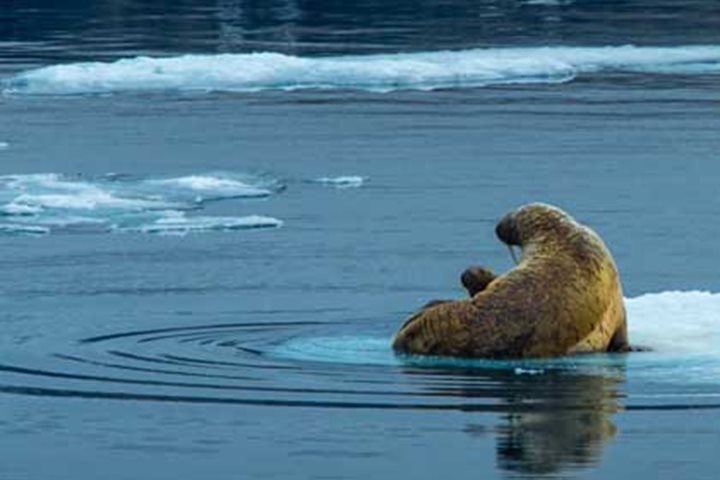
Leaving Baffin Island in our wake National Geographic Explorer arrived early morning in Lancaster Sound. This famous stretch of water was the route along which Sir John Franklin sailed his two ships, HM S Erebus and Terror , with a total crew of 129 men, in late 1845 on their ill-fated expedition to find the elusive Northwest Passage. Not a single man survived to tell the tale of this tragic adventure which exacted such a high price in human life. The waters of Lancaster Sound lap the southern shores of Devon Island where we spent the entire day observing a wide array of Arctic wildlife. Tracking along the coast, our first sighting was two walruses lying beside each other on a small ice floe. These are gregarious and tactile creatures. Their latin name is Odobenus rosmarus , the former meaning “tooth walker,” deriving from the animal’s ability to haul itself onto ice floes using its two tusks. Highly sensitive whiskers locate molluscs living in sediment on the sea bottom. Interestingly one of the animals was missing one of its tusks. These canine teeth have been much prized for centuries. In Medieval times Viking traders, who plied these waters brought walrus tusks to Ireland, Britain, and Mainland Europe. Here they were fashioned by highly skilled craftsmen into a variety of high status items. Harp seals were present in abundance with groups at a time surging in the water among the ice floes. In addition a large bearded seal reclined on a floe and “posed” for photos. But the best treat was what we thought was a lone walrus on a chip of ice, but as we got closer, the tiny head of young calf emerged from the mother: walrus Madonna and Child! Later on in the morning we headed into the broad sweep of Maxwell Bay. The cliffs here form a dramatic backdrop of alternating strata of ancient siltstones and sandstones dating back some 500 million years. Impressive scree slopes of shattered rock fragments were banked up along its base. The process of freeze-thaw, which causes the rock to flake and shatter, is responsible for the accumulation of these fan-shaped deposits. Thick-billed murres whirred through the air as our ship manoeuvered through the fast ice which was veritably peppered with ringed seals. And hunting these were a number of the king predator of the Arctic—polar bears. A female with her two cubs was particularly captivating. Hunkered down close to seal breathing holes, bears patiently waited for a chance to catch a meal. An azure sky was reflected in the leads through the ice. So an all-round fantastic expedition day of exploration and wildlife engagement on the remote shores of Devon Island in the Canadian Arctic.
8/5/2013
Read
National Geographic Explorer
Buchan Gulf & Icy Fjord, Baffin Island
This morning we awoke to fog so thick that we could barely see the bow of the National Geographic Explorer from the bridge as we navigated in Buchan Gulf, a deep gash carved in Baffin Island by the mighty Ice Age glaciers. Certainly less than ideal conditions for searching for the elusive narwhal, with its long tusk like the mythical unicorn, which was our plan for the morning. Then, without a hint of hope, conditions began to improve when miraculously narwhals began to appear ahead of the ship, as we moved ever so slowly forward. Narwhals are known to be very shy, rarely showing anything except a weak blow from a single blowhole and marbled patterns on their back lacking a dorsal fin. Always keeping their distance, we had great binocular views that thrilled us all, when suddenly a young whale swim right under the bow, appearing so fast that none of us snapped a picture. As the fog continued to clear, wisps of fog-like strokes from a painter’s brush clung to towering cliffs, as spires and mountaintops began to appear one after another. With each passing moment the scene changed and a strange thing happened—everyone out on deck was silent, except for the clicks of camera shutters and whispers of disbelief at what was unfolding before us, and in every direction. The glacially-carved landscape was on a scale that was unimaginable, like sailing into Yosemite Valley with not one, but dozens of Half Domes, which made me think of Ansel Adams and making black and white photos. The fractured, faulted, intruded, and deformed rocks exposed in the sheer cliffs date back to the Precambrian, more the 2 billion years ago when continents collided building the super-continent, Pangea. With the sun out in full force a call came over the radio, momentarily breaking the spell, “Hotel Manager, we have a guest wanting to book a future trip.” The timing could not have been any better, as next year the National Geographic Explorer will return to this area on its way to making the first-ever transit of the Northwest Passage by Lindblad Expeditions-National Geographic. The next radio call brought us quickly back to the moment, “Hotel Manager, you may not want to plate lunch just yet, we see a white furry animal ahead.” Indeed, lunch was delayed as we made a slow approach to observe a sleepy polar bear resting on the rocks just above the shoreline. It gazed at us once then fell back to sleep, before getting up slowly and nimbly walking across the boulders, stopping now and then to strike a pose, its well-groomed fur standing out in contrast to the dark, lichen-covered boulders. It’s always a humbling experience to see a polar bear in the wild, the top land predator in all the Arctic. As it navigated the rocks looking for its next napping spot, we finally went down to lunch. To enjoy more of our good fortune we went ashore this afternoon to explore the tundra. Intrepid long walkers headed up the prefect U-shaped valley, while the rest of us explored the Thule archeological sites along the base of the hillside and photographed wildflowers and metamorphic rock textures displayed in the boulders. Returning to the landing, to our surprise, a pulled-pork barbeque awaited us, complete with beer and soft drinks. What a great way to celebrate the day—one of the best ever in the high Arctic!
8/7/2013
Read
National Geographic Explorer
Padloping Island
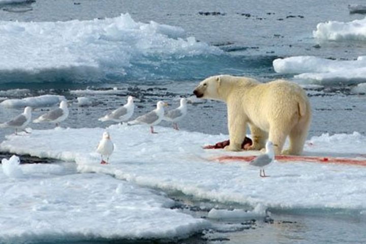
Nobody - not even the most extravagant of brochure writers - could have anticipated the number of polar bears that we have encountered along the coast of Baffin Island. We are always watching from the bridge of National Geographic Explorer , with a friendly competition between crew and natural history staff to be the first to spot a white dot on the hillside. Sometimes the dot transforms into a white rock. We have a laugh at ourselves and move on. But at other times, the white dot is a sleeping polar bear. It rouses, and ambles over the tundra or clambers over the boulders, a picture of languid grace. It is preserving energy to see it through the summer and into the season of plenty, when sea ice forms and it can hunt for ringed seals. This morning, however, our ice chart led us to a patch of residual sea ice, a remnant of last winter's frozen sea that has drifted south with the Labrador Current. Here we found a polar bear with the product of a successful hunt. It takes patience for a polar bear to hunt the seal, and it takes patience for our bridge officers to bring the ship, ever so slowly, into optimal viewing and photography range. It all came together this morning for a superb wildlife experience. Our bear seemed to be a young male, perhaps entering the prime of life (judging from the thick neck but with little scarring around the face that comes from battles with other males), and in good condition (judging from the well-rounded body.) Perhaps it had been drifting south with the ice. It had been feeding on the seal for some time. The layer of blubber is the first, and sometimes the only part of the seal to be consumed, and it was gone. The bear was sharing its kill with twelve or more glaucous gulls. It was well aware of us, but reluctant to abandon its kill. We left the scene. On the shore of Padloping Island, even within sight of the patch of sea ice, we spotted a bear ... and then another, and then more. Seven polar bears were clearly visible. High on the hillside above us was a female with two large, yearling cubs, lounging near a patch of bright magenta dwarf fireweed. Why was she so far above potential feeding areas? We speculate that she was avoiding the male bears that are a risk to her young, but soon she will have to find a meal, for the cost of lactation to provide for the needs of her two large cubs is high.
8/10/2013
Read
National Geographic Explorer
Lower Savage Islands, Nunavut
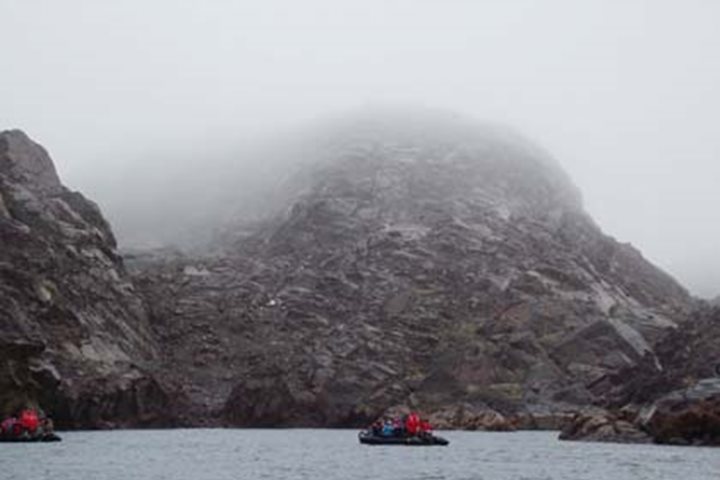
We spent the morning exploring the Lower Savage Islands, which are located just off the south-eastern tip of Baffin Island. Although aboriginal peoples are known to have inhabited these islands (at least seasonally) for hundreds of years, the first Europeans to note the islands were Robert Bylot and William Baffin aboard the ship Discovery in 1610. Because of their strategic location near the mouth of Hudson Bay, these islands became the site of an annual trading fair between the Inuit and the Europeans that continued for nearly three centuries. This dramatic and well-named archipelago consists of three main rocky islands stretching approximately eight miles in length with about the same distance in width. The islands are separated by long, narrow, steep-sided channels, which make them perfect for exploring by Zodiacs. Conditions seemed far from ideal when we first arrived, because it was foggy and drizzling, but the first intrepid group to go cruising found the inclement weather actually added to the mystery of the islands and produced some nice photographic possibilities. So, why the moniker Savage? The first Zodiac to enter into the channel at the north end came upon a polar bear meandering about on the rocky slope. We had not planned any landings here, and the bear simply reinforced that thought. Without landing to examine rocks closely, the geology of the Lower SavageIslands is a bit difficult to identify precisely, because the surface rocks are heavily affected by staining and/or coverage by lichens, mosses, etc. The islands appear to be either granitic or gneissitic in nature. They may actually be a combination of both, meaning some areas are simply exposed intrusive igneous material, i.e. granite, and other areas are exposed metamorphosed material, perhaps granite that has been changed into gneiss through the effects of intense heat and pressure. There is some obvious banding or foliation typical of metamorphism, but there is also much evidence of exfoliation, a process by which relatively thin layers of rock peel off from granite surfaces that occur from pressure release when the overlying burden is eroded away and the surface expands. Hydrothermal vents must have been active here in the distant past, judging by the impressive coatings of rust and sulfur compounds that seem to have emanated from many of the cracks. The geology has also been affected by glacial carving, judging from the smooth, rounded surfaces in the lower areas. Jagged, angular rocks in the upper regions give evidence of having been severely fractured and broken up by freeze-thaw effects. In the late afternoon, as National Geographic Explorer cruised northward in Baffin Island’s Frobisher Bay, we spotted another loosely organized pod of bowhead whales. What bizarre whales they are compared to our more familiar species. These are massive, rotund animals with huge heads that make up fully one-third of their body length. Bowheads are built for slow filter feeding, but definitely not for speed. Scattered icebergs and distant views of glaciers among mountains off both sides of the ship gave us a most enjoyable cruise during the afternoon and evening as we headed for our final port-o-call…Iqaluit.
7/31/2013
Read
National Geographic Explorer
Qilakitsoq, Western Greenland
We had a marvelous start to our day. Not long before breakfast a number of fin whales were spotted not far from the ship. Nicknamed the “greyhound of the sea” because of the speed they usually swim at, they are the second largest species of cetacean and we were treated to a truly amazing close-up sighting. Our morning activities concentrated on an exploration of the remote western coastline of Greenland in the area known as Qilakitsoq. The name means “the sky is low” and is a reference to the common occurrence here of fogs. After breakfast we made a shore landing on a pebbly beach that forms the entrance to a small semi-circular, low-lying grassy hollow. For centuries Thule hunter-gatherers lived here exploiting the rich marine resources of the area. Remains of a number of their sod- and stone-built winter dwellings and summer tents have been located, in addition to middens or refuse layers. The butchered bones of narwhal, beluga, seal, walrus, polar bear, ptarmigan, and dovekies have been identified and give us an insight into the diet of the inhabitants of this small community, which would have numbered around 30 people. Qilakitsoq is famous as the find spot of one of Greenland’s most important archaeological discoveries, namely eight ancient Thule mummies. Two ptarmigan hunters in 1972 noticed an unusual pattern in the stones lying beneath a rocky overhang and on closer inspection found the cache of mummies. They immediately notified the authorities but it was a further five years before the site was archaeologically investigated. The mummies were clad in full winter clothing made from seal and caribou skins and were interlayered with sealskin blankets. In Thule tradition it was believed that the journey to the next life was a long and cold one and so they had been well prepared for this. The mummy which caught the public’s attention was that of a six-month old child clad in sealskin anorak and pants. The mummies appear to have been buried over a period of time and specialist examination of the remains failed to ascertain the causes of death. They have been dated to around 1475 A.D. and four of the best-preserved are at present displayed in the National Museum in Nuuk. Many of the guests made their way down along the scree slope to the overhang to see the actual gravesite and explored the remnants of the ancient hunter’s camp. In addition there are a number of small stone-built graves containing the skeletal remains of erstwhile members of this Thule community who eked out a livelihood along this remote and inhospitable northern coastline over 500 years ago. In the afternoon there were a number of presentations in the lounge, which detailed various aspects of the area as the National Geographic Explorer made its way toward the coast of Canada across Baffin Bay.
8/2/2013
Read
National Geographic Explorer
Pond Inlet & Eclipse Sound, Nunavut, Canada
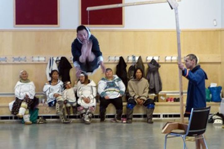
We have completed our visit to western Greenland and our passage across Baffin Bay to reach the Canadian North. In 1999 the former Canadian Northwest Territories was split; the portion occupied by the Inuit became Nunavut ("Our Land" in Inuktitut). All but the tiniest corner of Nunavut is above the treeline, hence experiencing the Arctic conditions that the Inuit, over generations, have mastered. The Inuit of Nunavut are proud to have their own homeland, and proud of their culture and traditions. We saw this clearly when we visited the community of Pond Inlet, on northern Baffin Island. We stepped ashore dry-shod after crossing the new "dry lander" (past guests have a surprise waiting when next they travel on the National Geographic Explorer ). We were greeted by Inuit women wearing traditional clothing made of furs. Our group split. Some chose to walk across the tundra and stretch their legs after the day at sea. Before the Canadian government built the hamlet of Pond Inlet, Inuit people lived nearby. They occupied sod houses during the winters and moved into skin tents for the summers, allowing the sod dwellings to air out. The remains of sod houses, and of rings of stones that once held down the edges of their tents against the Arctic wind, remain dotted over the landscape. Others of our group followed a local guide to the Community Centre for a demonstration of traditional Inuit drum-dancing, games of strength and agility, and throat singing. These helped the people pass the long, dark Arctic night. They could be joyful or they could be competitive, used to resolve disputes. Now they are definitely joyful, linking the people of Pond Inlet to their past. We departed Pond Inlet and headed further north, through the spectacular Arctic landscape of Eclipse Sound and then Navy Board Inlet, a narrow passage that separates Baffin and Bylot islands. Somewhat unexpectedly, the call came that we had spotted the first polar bear of our voyage. The animal appeared to be on the most barren of land. Could it possibly be getting any, if not enough to eat? Probably not. We watched our bear amble steadily northward, an off-white dot on the austere landscape. Perhaps, in heading north, it might find a patch of residual sea ice and access to the richness of food found there. Meanwhile, its keen sense of smell might lead it to a dead seal or whale that has washed ashore, enabling it to survive until new ice forms in autumn. Winter is their time of plenty; a polar bear on land is a hungry polar bear. At the northern tip of Bylot Island is Cape May, where many thousands of thick-billed murres breed. Each pair claims a tiny spot on a narrow ledge where they squeeze between their neighbors to incubate their single egg. Now, the eggs have hatched and the parent birds are busy bringing food to the growing young. Looking into the sky, we saw hoards of birds on the wing, each returning to its nest site with a load of small fish before heading out to sea to do it again, male and female, coming and going. It takes all of the efforts of both parents to raise a single young. Soon, long before the young birds are able to fly, they will leap from the ledges to follow their fathers out to sea, and the cliffs will fall silent for the winter. After spending the winter apart, the adults will meet at the cliffs again next year to repeat the process. It was a spectacular sight, and evidence of the richness of the Arctic marine environment. And so to bed.
8/4/2013
Read
National Geographic Explorer
Dundas Harbour & Southern Coast of Devon Island
The year is 1924. Imagine being one of three men dropped at 74 ̊31’ 32” north latitude in one of the most remote regions of the Canadian High Arctic, with no communication and your only contact with the outside world passing through once a year via ship. Now imagine being the only one of the three who survives your three-year charge and having to report to the Royal Canadian Mounted Police (RCMP) what happened since last time they saw you. This was the scene in 1927 when Constable E. Anstead was finally taken home after isolation, and an accident, took his two companions during their service at the eastern entrance to the fabled Northwest Passage. For nearly three years these men lived in a cluster of wooded structures at the southern end of Devon Island in a place called Dundas Harbour. National Geographic Explorer pulled into Dundas’ protected anchorage this morning to overcast skies, a chill in the air and the scent of walrus wafting on the wind. Located not far from the remains of a former Thule site, about a dozen hauled-out walrus served as an example as to how these two different groups, at two very different time periods, were able to withstand such a harsh environment for extended periods of time. Near our Zodiac landing site were well-preserved remains of what once were the houses, burial sites and rubbish heaps of the descendants of modern-day Inuit, the Thule. No doubt designed for the high winds and bitter cold of a high arctic winter, the remains of these houses show what must have been a very low-profile structure built of stone and likely topped with whale bones and sod at one time. All that remains are their lichen-encrusted circular foundations. Nearby were a few grave sites and further on still the mother load — a midden! This particular midden held the remains of whatever these Thule discarded seven to eight hundred years ago when they lived here. Their trash heap was littered with whale, dog, caribou and even polar bear bones and showed clear signs of tool use. A great site for those archeologists at heart. For those historians at heart our morning ashore eventually shifted to the east and led us to the remains of the aforementioned RCMP site. While wind battered and dilapidated the remaining structures and gravesite served as a sobering reminder not only of the harsh conditions these mounted police endured but of the dedication they had to their national defense. From the southern shores of Devon Island we plied east through the afternoon until making a turn to the south which will lead us all the way along the eastern coast of Baffin Island over the next few days. It wasn’t long after this right-hand turn before a pod of killer whales slowed our transit and occupied us for the next hour with close passes across our bow and crisscrossing under our ship. As many as eight animals filled our viewfinders at any one time, occasionally passing in line with distant icebergs to set the stage for what was a dramatic close to our time in the furthest reaches of our voyage.
8/6/2013
Read
National Geographic Explorer
Isabella Bay and Arctic Harbour, Baffin Island
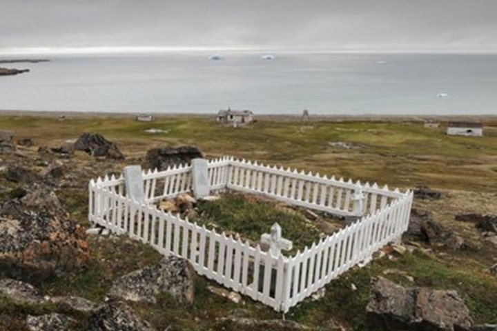
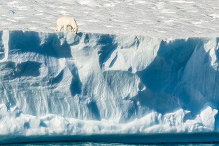
Sunrise came early this morning (02:43) to all on board National Geographic Explorer , breaking in hues of red and orange. The ship’s bow sliced cleanly through glass-flat water as we approached Isabella Bay on Baffin Island. Breakfast being served was the only thing to disturb the relative quiet and calm of the growing day, when the call came from the bridge that polar bears had been spotted on a huge iceberg at the entrance to the bay. Creamy yellow bodies emerged from the blue-white backdrop as first one bear, then two, then three, and finally six ice bears were sighted all on the same floating temporary home. Excited bear enthusiasts spilled out onto the deck spaces as binoculars were raised, camera lenses were focused, and subdued voices shared bear positions up and down the iceberg. With a backdrop of Baffin Island itself, this huge iceberg had become a literal polar bear magnet! Cameras clicked and whirred as gigabyte after gigabyte of bear photos filled memory cards and prompted many to have to return to their cabins for fresh cards. The scene lay out before us as absolutely picture perfect and Captain Oliver Kruess slowly maneuvered the ship along the ice face, giving us an endless variety of angles and views of our furry friends. Leaving the bears just as we had found them, we now turned further into Isabella Bay. We hadn’t gotten very far at all when blows were sighted off the bow. Whales! Further inspection confirmed what we had been hoping for; not just any whales, but bowhead whales! We crept ever so delicately closer as massive heads began to emerge at the base of large, V-shaped blows. With Baffin Island again the perfect backdrop, we started seeing single whales, and then by twos and threes, and finally a dozen or so at once. We were literally surrounded in perhaps 30 or so bowhead whales, each of whom would raise its mighty flukes at the end of a breathing sequence. At nearly 60 feet in length, and well over 200,000 pounds in weight, these are mighty leviathans indeed. Afternoon found us in Arctic Harbour at the former site of a 19 th -century British whaling station. Groups of hikers fanned out across the tundra looking at and pondering the lifestyle that these men had endured at such a remote location. Four graves stood in testament to just how arduous a life this must have been. By the 20 th century these whales were literally taken to commercial extinction. As our whales this morning had indicated, bowheads are now making a comeback here in the Canadian Arctic. Once believed to number only a few hundred individuals, recent surveys have found that the eastern bowhead population may now be as high as 14,000. Towards that recovery the Canadian Government can be credited with the formation of the Niginganiq National Marine Wildlife Area, a preserve established specifically for the protection of bowhead whales here in Isabella Bay and along the northeast coast of Baffin Island. Once again bowhead whales are freely frolicking in these waters, surrounded by the majesty of the snow-covered peaks of Baffin Island!
8/8/2013
Watch
National Geographic Explorer
Hoare Bay & Saxe-Coburg Island, East Baffin, Nunavut
We had planned to sail into Hoare Bay this morning and explore shore side at some opportune landing site in Auyuittuq National Park on Baffin Island’s Cumberland Peninsula. We never made it. This eastern region of Baffin Island is a seasonal concentration point for sea ice that drifts southward in the Davis Strait with the Labrador Current. We love the ice, and this particular ice pack sometimes remains intact here through much of the summer. And, as we soon discovered, it is an excellent region to search for polar bears. Before breakfast, we reached loose pack ice and an announcement was made informing everyone of walruses sighted on an ice floe. That was a great start in the morning, but before long we had our first polar bear of the day…then another…and another. Conditions could not have been better with partly cloudy skies, glass-smooth water with beautiful reflections, brilliant ice floes, and bears! Lots of bears. At one point in time, we could see nine bears scattered about, including a mother and cub, two swimming bears, and one on a seal kill. It would be hard to imagine the number of digital images produced this day. Every time we pulled away from a bear, we soon sighted another one doing something equally interesting. It was astounding to have two separate bears both approach the ship on ice floes one right after the other in mid-morning. Another one actually slid into the water off its floe and swam over to investigate the ship. Everyone found his or her favorite spot on the ship from which to sight and photograph bears…many were on the foredeck, some liked the outside vantage from in front of the chart room (just below the bridge), quite a few were in the bridge itself, and a bunch of us went for the higher view from the sundeck (right above the bridge). During lunch, the vessel set off in anticipation of reaching the Cape Mercy region sometime in the afternoon. But, as you might suspect, we encountered more bears in the ice. Our wonderful ship showed what she does best, that is, pushing her way through the pack ice and then gently maneuvering about the floes to get good views of the bears. By mid-afternoon, we made our way back out of the pack ice and continued southward to a small island named Saxe-Coburg located just off Cape Mercy. We had it on good authority there could be walruses hauled out on it, so it seemed the perfect place for a late afternoon Zodiac cruise. Well, guess what. The first thing we discovered when approaching the rocky island was a large, very white polar bear relaxing on a steep slope. He had chosen the top of a wide, vertical quartz vein exposed in the surrounding gneiss for his lookout post. We wondered if he had done this on purpose in order to hide himself or if it just happened to be a convenient spot. No walruses were sighted, but there were lots of beautiful little black guillemots flocking around the shoreline, many of whom carried single capelins in their beaks. It had proven to be a spectacular day of ice, scenery, and wildlife… what more could a person ask for?
8/12/2013
Read
National Geographic Explorer
Nobel Inlet, Baffin Island
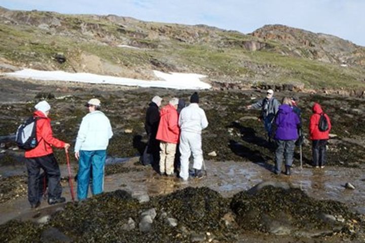
This morning would be our first aboard Na tional Geographic Explorer during our 15-day expedition along the Baffin Island and Greenland coasts. Introductions were done by the natural history staff and information given about what to expect on our walks, hikes and Zodiac cruises as well as how to dress and the importance of staying with our groups in polar bear country. After that we were all decontaminated! This was not as extreme as it may sound. Because traveling in marginal environments can be damaging to them, an inspection was done of outer layers of clothing as well as boots to make sure no introduced seeds or soil would be spread. Later in the morning the photo team gave us some helpful hints for the photographic portion of our expedition. During the afternoon we sailed to a place recommended by our Canadian ice pilot, Ray Jourdain—a small inlet on a small island called Noble Inlet. Just as walks and hikes were being organized, the first polar bear of the expedition was spotted by one of our guests! The bear was napping on land and was woken up by our approach. He quickly settled back into his summer slumber as we learned about the Arctic Baffin Island ecology by the naturalist on shore. Many of the summer flowers were still blooming including the moss campion. Some groups stayed closer to shore and enjoyed learning about the tide pools. Once back on board we all enjoyed the Captain’s welcome aboard cocktail party and dinner.
Showing 12 of 310

